2.2 地质灾害危险性评价方法
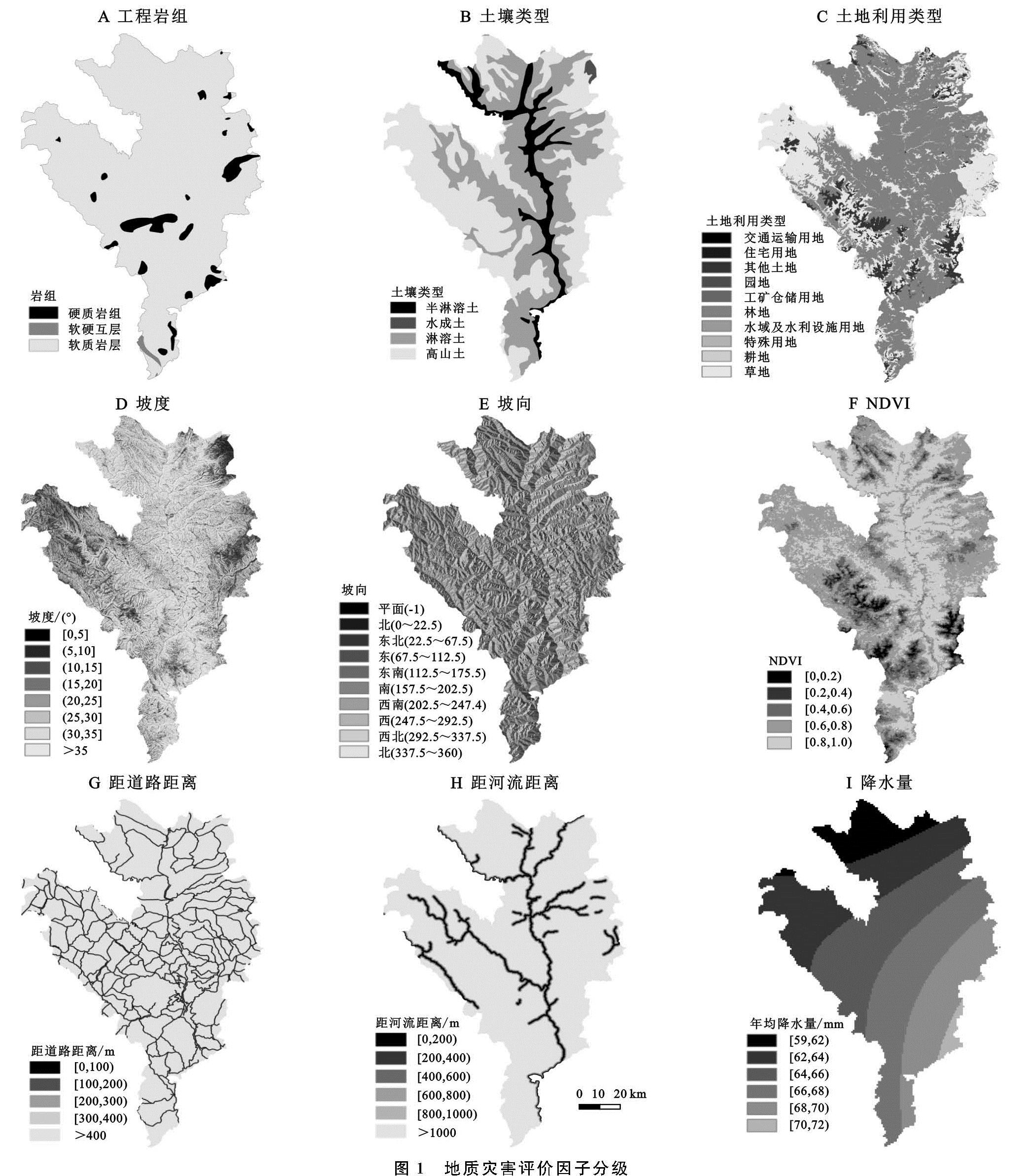
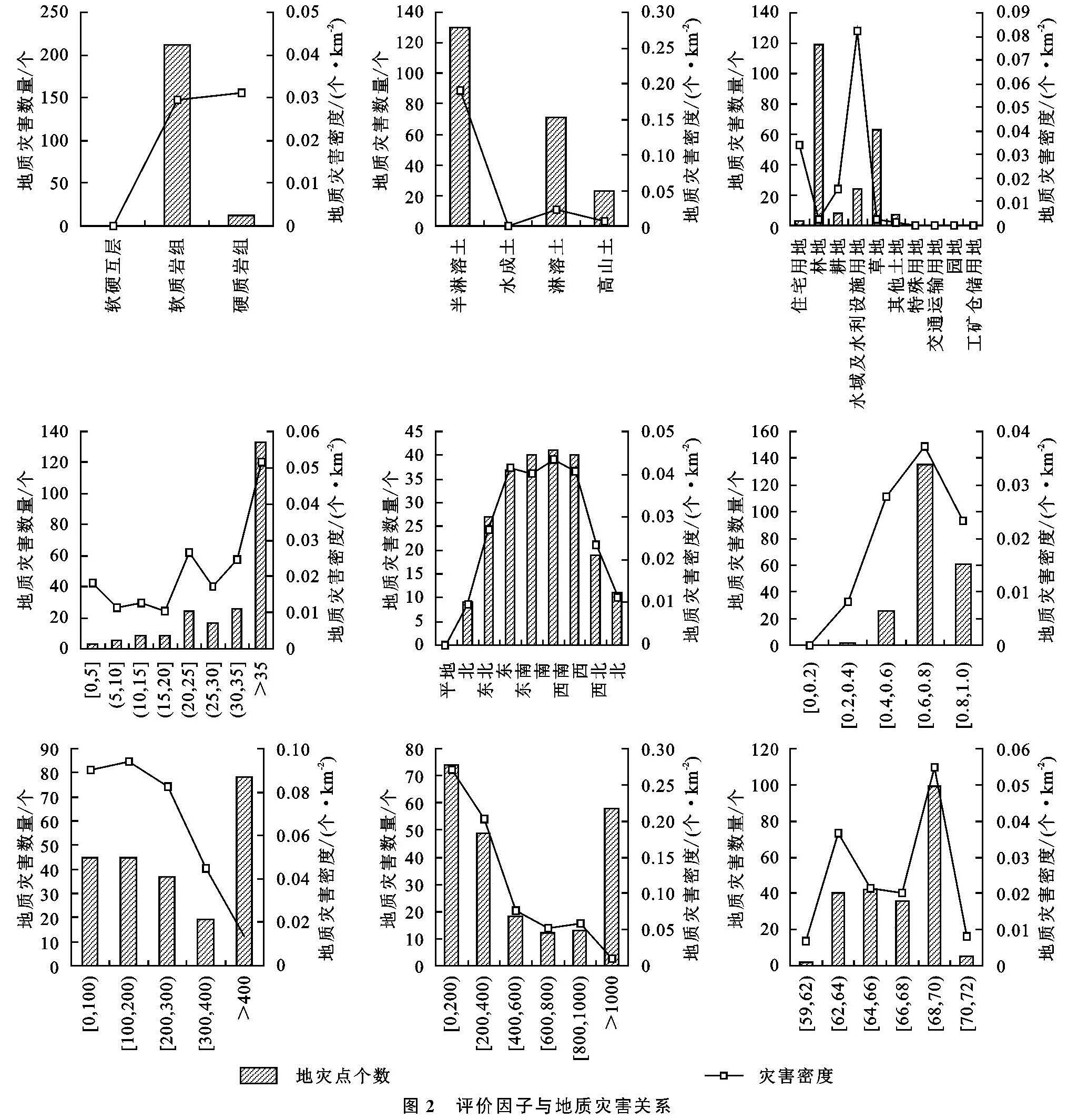
2.2.1 评价因子选取 地质灾害危险性受多种因素影响和制约,并且不同因素对其影响和制约程度也不同[16-18]。合理地选择评价因子才能更加准确地做出地质灾害危险性评价,每个研究区具体情况不尽相同,都具有其自身特点,因此评价因子也需要谨慎考量,本研究区评价因子的选择不仅参考了大量已有研究成果,还结合了雅江县当地崩滑流地质灾害的实际情况和具体特点。最终选择工程岩组、土壤类型、土地利用类型、坡度、坡向、NDVI、距河流距离、距道路距离和降水量等9个因子进行雅江县地质灾害危险性评价,各评价因子分级情况见图1。基于软件ArcGIS 10.6,由DEM数据生成雅江县坡度和坡向数据; 距河流距离和距道路距离因子分别根据雅江县河流和道路分布图利用缓冲区功能分析计算提取; 降水量数据根据1989—2018年雅江县周边6个气象站点多年平均降水量,运用Kriging方法进行插值得到雅江县内降水空间分布图。
2.2.2 信息量法 信息量法源于信息理论,是一种对数化随机分布概率以解决度量问题的定量统计预测方法,早已被广泛应用于滑坡、斜坡稳定性的空间预测等环境地质研究中。信息量法的应用思路可简单理解为通过计算某种地质因素提供的研究对象的信息量值,根据其大小来评价其与地质灾害发生的关系[8-14]。信息量法在地质灾害评价中的使用,使得各评价因子与地质灾害的关系紧密程度被更直观、数字化地表达。
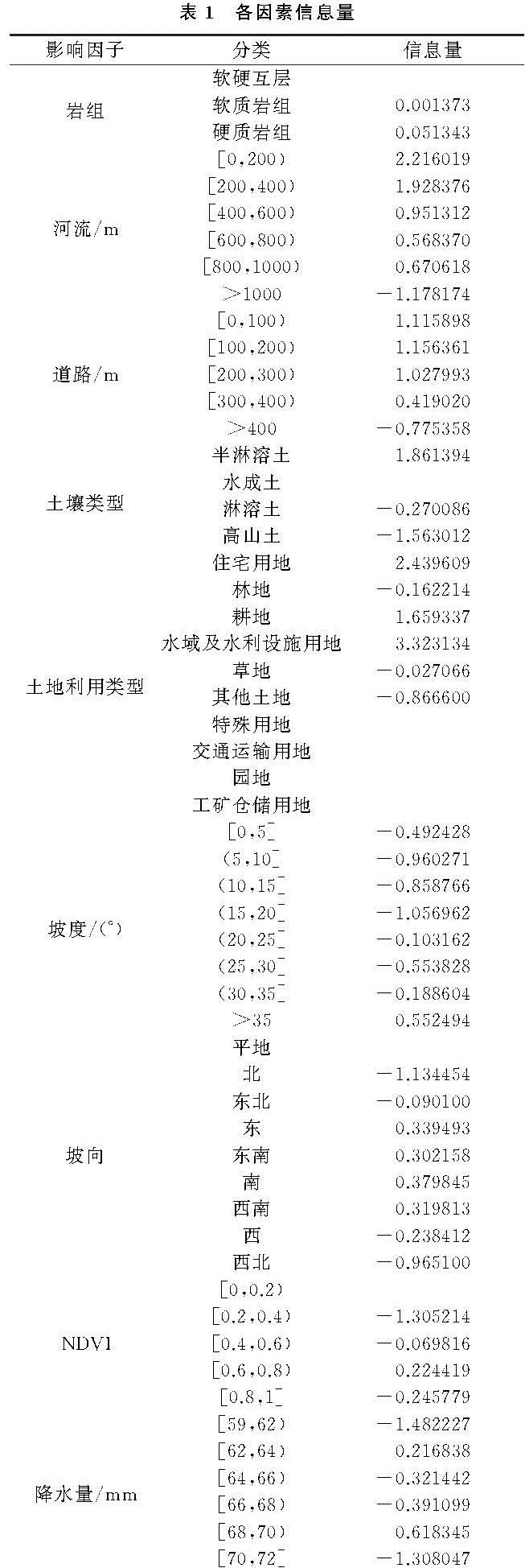
信息量是条件概率运算,但在实际应用时各评价因子对地质灾害发生的贡献率是用样本频率来计算:

式中:S为研究区评价单元总数; N为研究区有地质灾害分布的单元总数; Si为研究区内含有评价因素Xi的单元数; Ni为分布在因素Xi内特定类别内的地质灾害单元数。
单元的危险性等级由总信息量值I来确定,各评价因子单元的综合信息量值越大,表示其贡献率越大,则越有利于地质灾害的发生,意味着该区域危险性等级越高,反之,贡献率低不利于地质灾害发生,其危险性也就越低。需要计算出所有单元格综合信息量值,根据其值大小进行类别划分,得到等级不同的危险区。

式中:I为评价单元总的信息量值; n为参评因子数。
根据前面的分析结果,选取土壤类型、坡度、坡向、工程岩组、降雨量、距道路距离、距河流距离、归一化植被指数(NDVI)和土地利用类型9个指标因子开展地质灾害危险性评价。
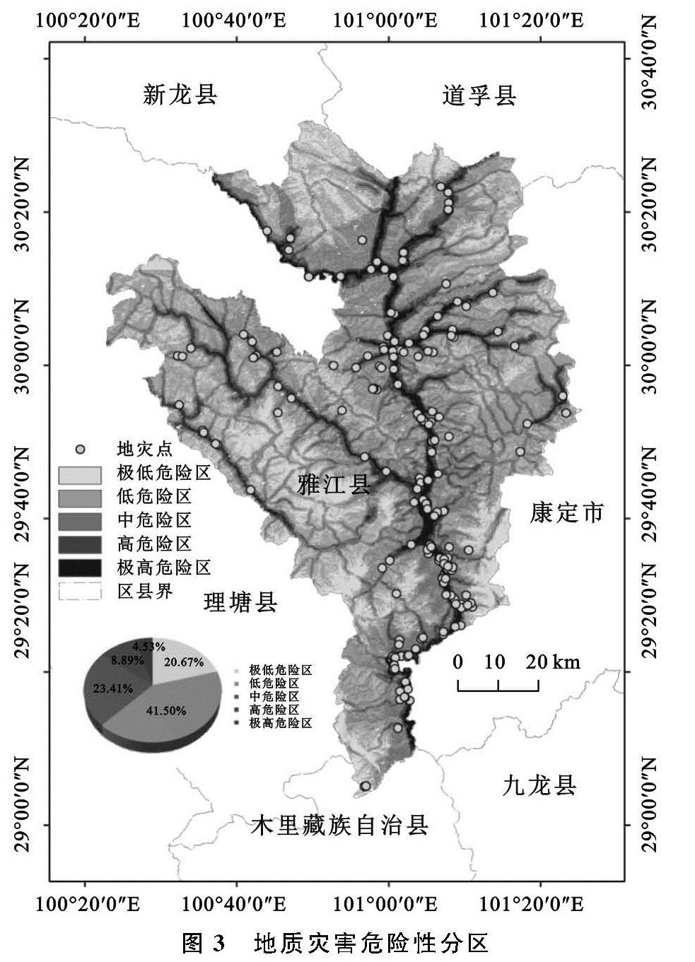
首先,利用ArcGIS软件平台,将各评价因子的基础数据转化为30 m×30 m的栅格数据,再分析各评价因子与地质灾害点的空间位置关系并根据公式(1)计算每个评价因子下的每个等级信息量值,最后利用公式(2)以及叠加9个评价因子含有信息量值的图层,依据其综合信息量值大小重分类,得到赋有综合信息量值的研究区地质灾害危险性分区图。