2.1 数据来源
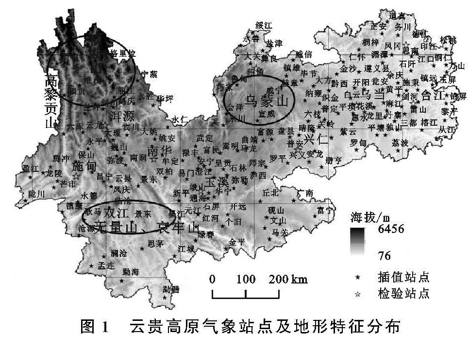
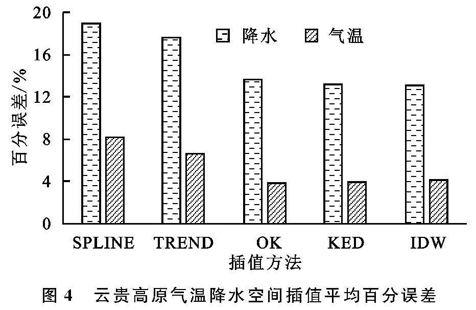
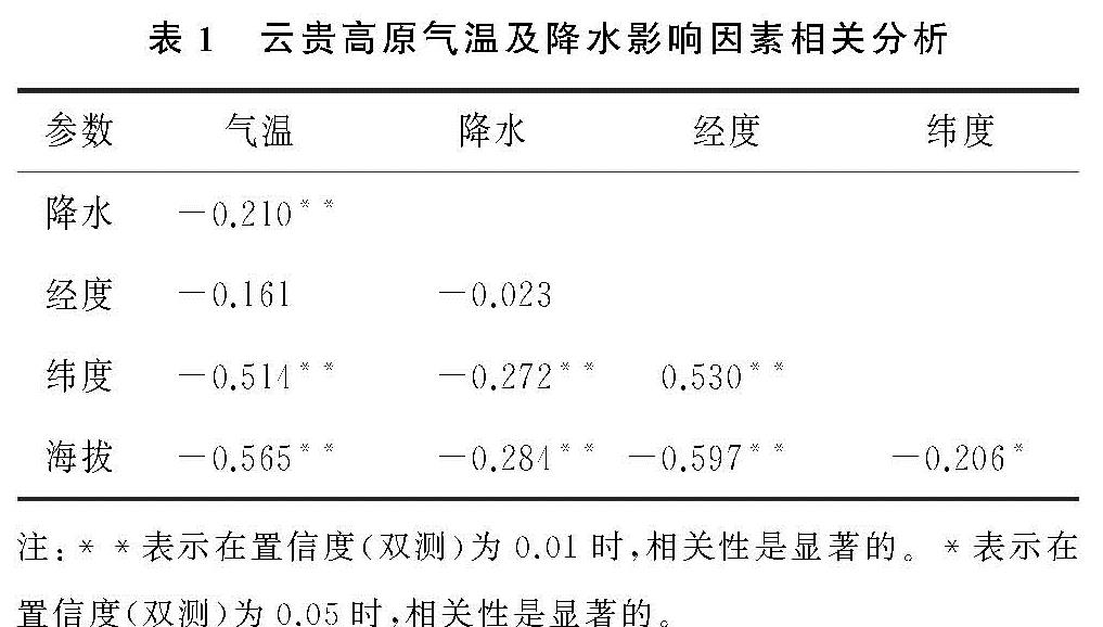
气温与降水数据来源于中国气象网(https:∥data.cma.cn),DEM数据下载于中国科学院计算机网络信息中心地理空间数据云(http:∥www.gscloud.cn),DEM数据分辨率为90 m,气温与降水数据为1981—2010年多年平均气温与降水数据。数据下载完成后,对各类数据进行空间匹配与异常值剔除,最终选取180个气象站点作为本文研究对象,其中贵州境内76个,云南境内104个。参考以往研究[10],需选取一部分站点作为检验站点。本文共选取了10个气象检验站点,分布于云贵高原不同的位置,其占比约为5.56%。
2.2 研究方法
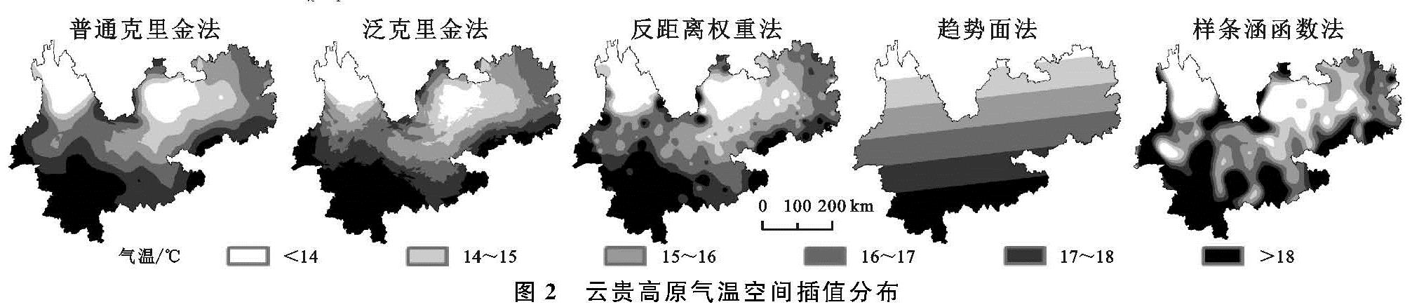
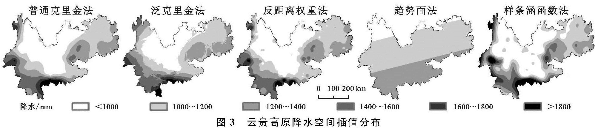
(1)克里金插值。该方法利用半导函数计算系数,得到最优估计值,优势在于考虑样本空间随机特征[11-12]。有普通克里金(OK)和泛克里金(KED)两种方法,公式分别为[11-12]
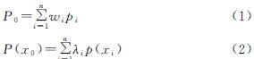
式中:P0为待估计值; wi为点i的已知值; pi为点i的权重; n为用于估算气象站点数量。p(xi)为以r为半径的领域内在观测数据点xi处的观测压力值; λ为权重系数; P(x0)表示无偏最佳估计值。
(2)反距离权重法(IDW)。反距离权重是对已知点与待估点距离进行加权平均的值,原理是两点距离越大,差异越大,呈正相关[12-13]。公式见式(3):
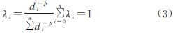
式中:di为待估点到i点距离。p为指数,一般是2。
(3)趋势面法(TREND)。趋势面法是在多项式回归分析后,得到适合地理要素空间分布规律,在曲面平滑程度的基础上,计算待估点的属性值[14]。公式见式(4):
Z(x,y)=∑n0k=0∑kiak,jkxk-iyi+ω(4)
式中:z(x,y)表示气象站点估计值; n0为多项式阶数; ω为随机误差; ak为观测点系数; x,y为平面直角坐标值。
(4)样条函数法(SPLINE)。样条函数是利用多项式模拟样本点产生平滑插值,优势能较好体现局部地区的真实性[14]。公式如下:
Z=∑ni-1βiR(di)+T(x,y)(5)
式中:Z是估计值; n表示样本数量; β表线性方程系数; di为待估点到i点距离; x,y表示平面直角坐标值。
(5)地理加权回归。地理加权回归模型中的参数是表示区域地理位置的函数,其主要优势为能够将空间权重矩阵运用在线性回归模型之中,并很好地展现结果的空间结构分异[15-16]。公式为:
yi=β0(ui,vi)+∑mk=1βk(ui,vi)xik+ωi(6)
式中:βj(ui,vi)表示第i个区域上的第j个回归参数; xij为第i个样本点的第m个解释变量; ωi为随机误差项。