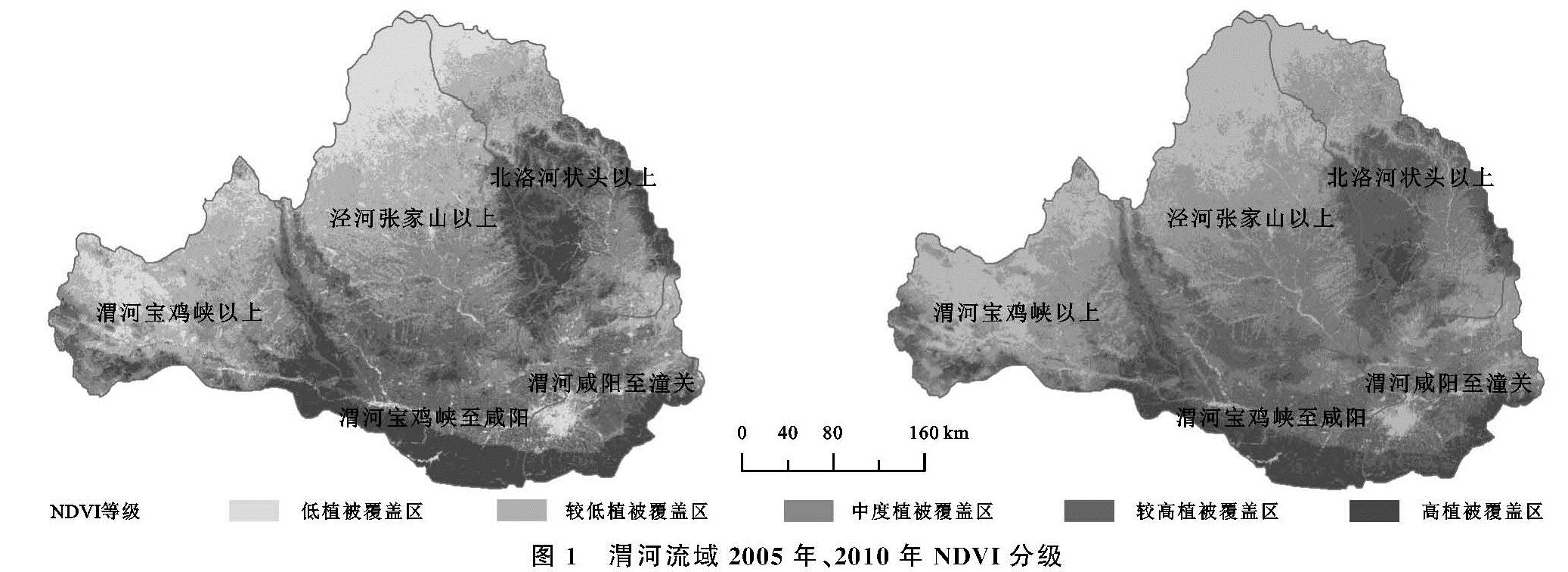
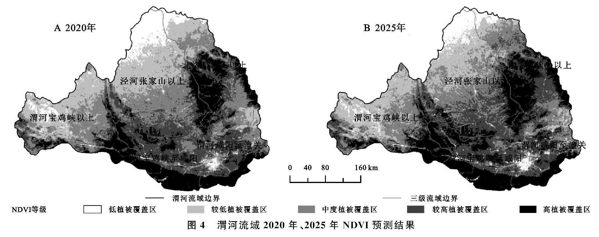
(1)渭河流域NDVI空间分布存在一定差异。低度植被覆盖区、较低植被覆盖区主要分布于陇中和陕北黄土高原地区,中度植被覆盖区主要分布在泾河和北洛河河谷地区,较高植被覆盖区主要分布在关中平原、子午岭等地,高度植被覆盖区主要分布在秦岭、六盘山。
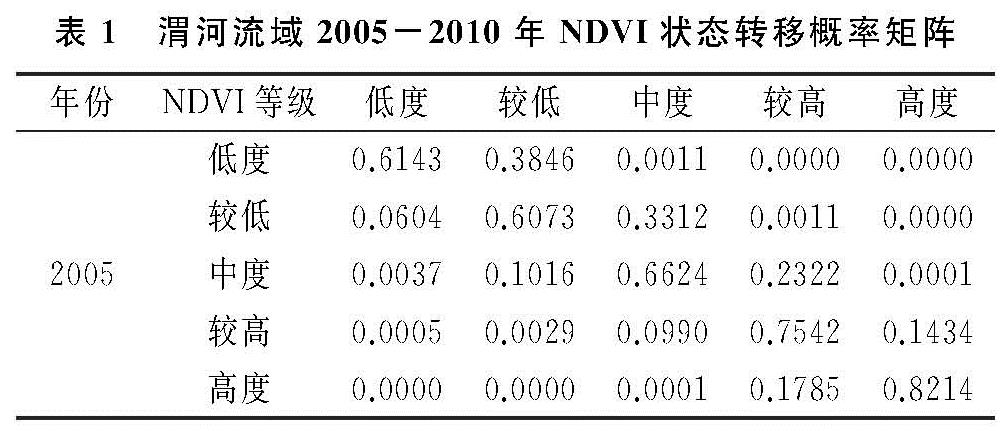
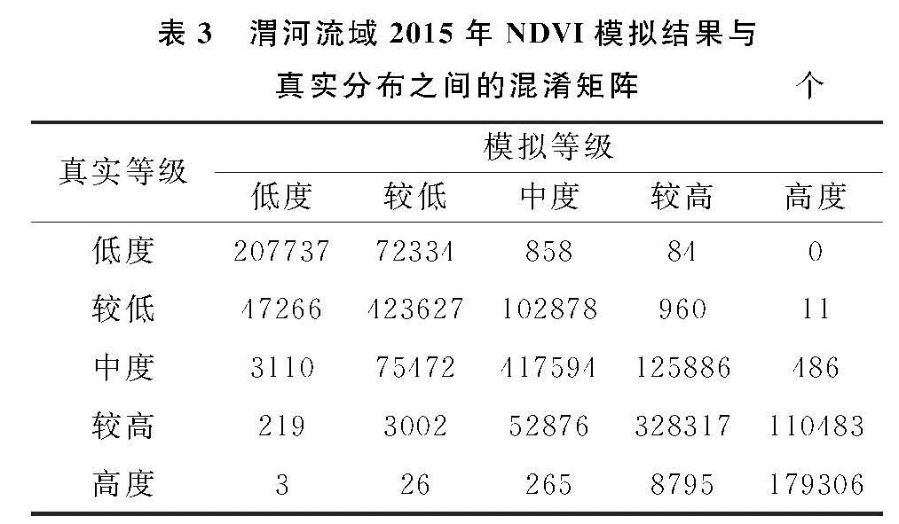
(2)CA-Markov模型对于模拟植被动态变化具有较好的适用性。利用CA-Markov模型对渭河流域植被的空间分布进行模拟,结果表明模拟结果与NDVI真实分布之间Kappa系数达到0.785 0,叠置分析和随机取样检验的精度分别为72.0%,73.4%,与原影像分级图之间具有高度的一致性,说明在政策环境和气候变化相对稳定的条件下,利用CA-Markov模型定量地预测某一区域的植被覆盖分布状况的变化是可行的。
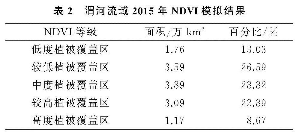
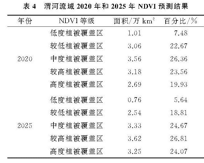
(3)渭河流域NDVI时间变化规律明显。整体上,2015—2025年,流域植被覆盖状况将进一步改善。低度植被覆盖区、较低植被覆盖区、中度植被覆盖区面积逐渐减少,向更高一级植被覆盖区转移,低度植被覆盖区发生转移的区域主要在流域西北部和渭河沿岸的城镇地区; 较低植被覆盖区发生转移的区域主要在泾河流域和北洛河流域,其一方面向北侵占低植被覆盖区的面积,另一方面南部被中度植被覆盖区侵占; 中度植被覆盖区整体向北迁移; 较高植被覆盖区和高度植被覆盖区面积进一步增加,空间上向北扩张。
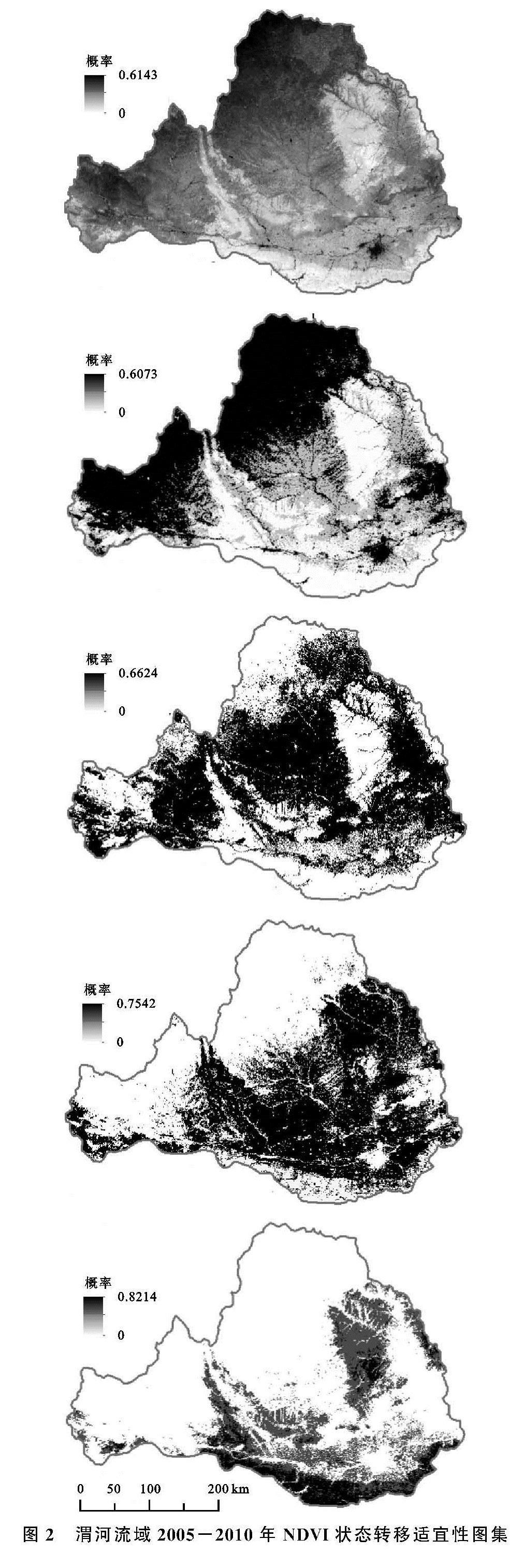
传统的空间模拟及预测依据大量数据作回归分析,以回归方程估算属性特征,其分析过程及模拟结果存在较多不确定性。本文利用CA-Markov模型,其工作原理是以预测基期的植被覆盖空间分布为初始状态,以基期和之后各级植被覆盖区转移面积及适宜性图集表述的像元适宜NDVI为依据,对植被覆盖空间分布进行重新匹配,从而得到预测的各级植被覆盖区面积,有效地模拟和预测了植被的时空分布特征。
需要指出的是,目前CA-Markov模型主要用于土地利用格局的模拟和预测,对于植被覆盖的模拟和预测研究甚少。植被作为地表覆盖的一种用地类型,其动态变化实质上也是土地覆盖的动态变化,因此研究尝试利用CA-Markov模型进行植被覆盖分布的模拟预测。CA-Markov模型的参数涉及时间间隔、数据尺度、滤波器等,对模型精度均有影响。本文选用最大值合成法对每月的两期NDVI数据进行合成,减少NDVI数据的噪音; 另外针对不同滤波器参数下的模拟结果做了精度比较,发现5×5型滤波器模拟结果的准确性最高,因此选用5×5型滤波器,提高模型模拟精度。
同时,植被覆盖变化是一个复杂的过程,不仅受到气候变化、自然灾害等诸多自然因素的影响,而且受到土地利用政策、社会经济发展及其他人类活动等不确定因素的影响,因此,如何综合考虑多种因素设置CA-Markov模型的各参数是今后需要深入探究的科学问题。