植被是陆地生态系统中的重要组成部分,在全球物质循环和能量流动中有重要作用[1]。研究地表植被盖度及其变化,对于揭示植被生长状况,空间分布规律,评价区域生态环境质量具有重要意义[2-3]。同时植被在防治土壤侵蚀过程中有重要作用[4]。一方面,植物冠层能够拦截降雨,植物枯枝落叶层能够增加入渗来减少径流[5]。另一方面,植被能够阻挡泥沙运移,减少水土流失[6-8]。在植被与土壤侵蚀的关系研究中,植被覆盖是影响土壤侵蚀的重要指标。传统的植被覆盖测量虽然在不断改进,但仍然有野外操作不便、成本较高、难以快速大范围动态监测等缺点,而遥感技术可以有效解决这一问题[9-11]。归一化植被指数(Normalized Difference Vegetation Index,NDVI)能够相当精确地反映植被盖度、生长状况、生物量以及光合作用强度等,是目前最常用的植被指数[12-14]。为了进一步认识植被与土壤侵蚀的关系,有必要研究植被的时空变化对土壤侵蚀风险性的影响。
土壤侵蚀风险性研究主要依据土壤侵蚀预报模型,国际上先后开发了通用土壤流失方程(Universal Soil Loss Equation,USLE)、修正的通用土壤流失方程(Revised Universal Soil Loss Equation,RUSLE)、水蚀预报模型(Water Erosion Prediction Project,WEPP)、欧洲水蚀预报模型(European Soil Erosion Model,EUROSEM)等。此外一些学者基于USLE建立了若干侵蚀预报模型[15],但是以上土壤侵蚀预报模型都需要获取降雨侵蚀力、土壤可蚀性、坡度坡长、作物覆盖和水土保持措施因子基础数据,且需要多年长期监测数据,在基础设施薄弱的地区并不适用。有学者基于植被盖度、地形和土地利用进行水土流失风险评价,使得大范围长时间尺度的土壤侵蚀研究成为可能[16-18]。遥感技术能够对地形、植被覆盖、土地利用方式和地表裸露程度等土壤侵蚀的重要标志进行规则重复的观测,是进行动态环境监测的重要技术手段,目前被广泛应用于土壤侵蚀监测[19-20]。彭文甫等[21]利用Landsat5/8影像研究了岷江汶川—都江堰段植被覆盖动态变化; 彭双云等[22]利用RUSLE模型对滇池流域1999—2014年土壤侵蚀时空演变进行了分析; 陈学兄[23]利用坡度和植被盖度的指标对中国水土流失进行评价。
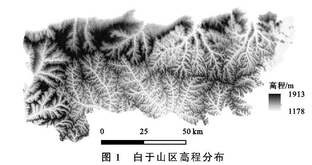
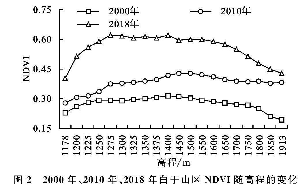
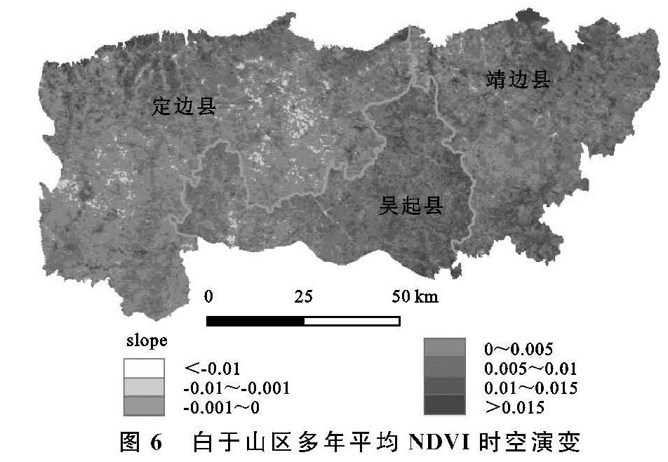
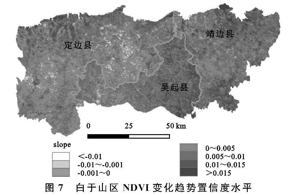
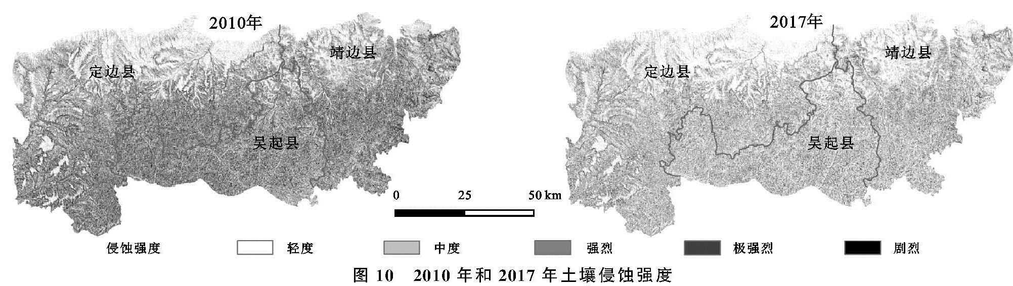
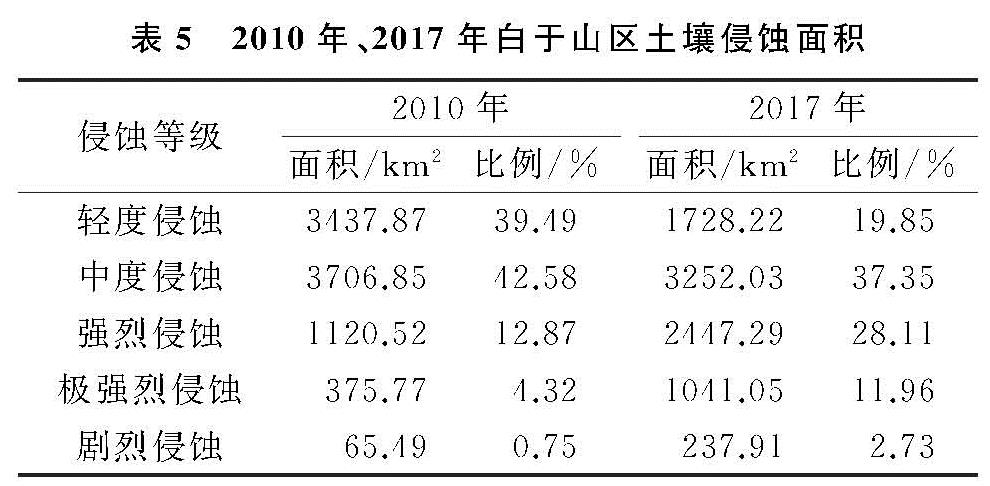
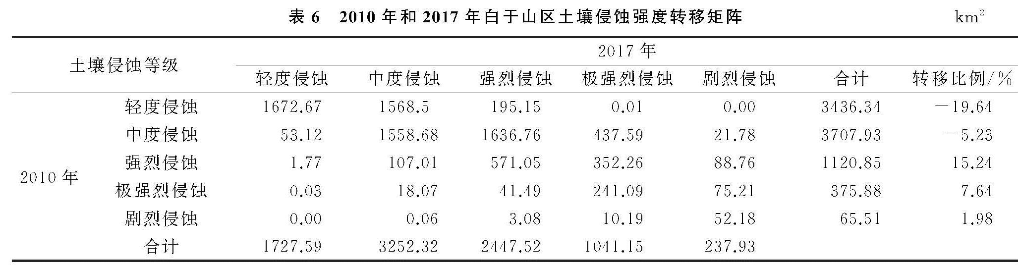
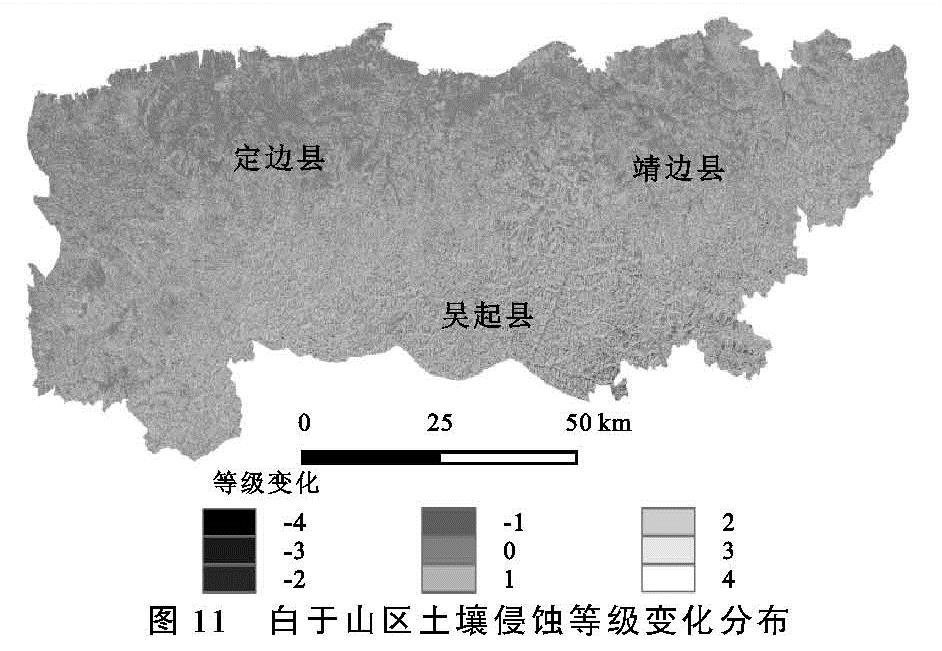
白于山区是陕西省水土流失最为严重的地区之一,该地区气候干旱,降雨集中,地形破碎,加之退耕实施不彻底,经济发展落后等因素的影响,导致区域水土流失现象并未明显缓解,土壤侵蚀风险一直较高。但目前对其土壤侵蚀的评估还较少涉及,因此快速评估白于山区植被状况和土壤侵蚀风险,对水土保持措施决策提供依据具有非常重要的意义。为此,本文利用MODIS-NDVI和Landsat数据,结合GIS手段,分析白于山区退耕还林(草)以来植被覆盖和土壤侵蚀强度变化特征,为该地区生态环境建设提供科技支持。